Weather Alert in California
Special Weather Statement issued July 29 at 7:33PM PDT by NWS Eureka CA
AREAS AFFECTED: Coastal Del Norte; Northern Humboldt Coast; Southwestern Humboldt; Mendocino Coast
DESCRIPTION: ...TSUNAMI ADVISORY IS IN EFFECT FOR THE BEACHES DEL NORTE, HUMBOLDT, AND MENDOCINO COUNTIES... * LOCAL IMPACTS... A tsunami capable of producing strong currents that may be hazardous to swimmers, boats, and coastal structures is expected. Widespread inundation is NOT expected. * RECOMMENDED ACTIONS... If you are located in this coastal area, move off the beach and out of harbors and marinas. Do not go to the coast to watch the tsunami. Be alert to instructions from your local emergency officials * FORECAST TSUNAMI START TIMES... Fort Bragg California 1150 PM PDT on Jul 29 Crescent City 1150 PM PDT Jul 29 Tsunamis often arrive as a series of waves or surges which could be dangerous for many hours after the first wave arrival. The first tsunami wave or surge may not be the highest in the series. * FORECAST TSUNAMI DURATION... Fort Bragg California 9 hrs Crescent City 36 hrs * FORECAST PEAK TSUNAMI WAVE HEIGHTS... Fort Bragg California 0.8 to 1.4 ft Crescent City 2.9 to 5.4 ft * PRELIMINARY EARTHQUAKE INFORMATION... An earthquake occurred with a preliminary magnitude of 8.8. * TIDE INFORMATION... Humboldt Bay North Spit...Low tides of 1.3 ft at 901 AM PDT on Jul 30, and 1.8 ft at 1008 PM PDT on Jul 30. High tides of 5.2 ft at 259 AM PDT on Jul 30, and 6.2 ft at 343 PM PDT on Jul 30. Crescent City Harbor...Low tides of 1.3 ft at 854 AM PDT on Jul 30, and 1.8 ft at 1002 PM PDT on Jul 30. High tides of 5.2 ft at 249 AM PDT on Jul 30, and 6.3 ft at 329 PM PDT on Jul 30. This product will be updated as new information becomes available. Stay tuned to your local news source and NOAA weather radio for further information and updates.
INSTRUCTION: N/A
Want more detail? Get the Complete 7 Day and Night Detailed Forecast!
Current U.S. National Radar--Current
The Current National Weather Radar is shown below with a UTC Time (subtract 5 hours from UTC to get Eastern Time).

National Weather Forecast--Current
The Current National Weather Forecast and National Weather Map are shown below.

National Weather Forecast for Tomorrow
Tomorrow National Weather Forecast and Tomorrow National Weather Map are show below.

North America Water Vapor (Moisture)
This map shows recent moisture content over North America. Bright and colored areas show high moisture (ie, clouds); brown indicates very little moisture present; black indicates no moisture.

Weather Topic: What are Contrails?
Home - Education - Cloud Types - Contrails
 Next Topic: Cumulonimbus Clouds
A contrail is an artificial cloud, created by the passing of an
aircraft.
Contrails form because water vapor in the exhaust of aircraft engines is suspended
in the air under certain temperatures and humidity conditions. These contrails
are called exhaust contrails.
Another type of contrail can form due to a temporary reduction in air pressure
moving over the plane's surface, causing condensation.
These are called aerodynamic contrails.
When you can see your breath on a cold day, it is also because of condensation.
The reason contrails last longer than the condensation from your breath is
because the water in contrails freezes into ice particles.
Next Topic: Cumulonimbus Clouds
Weather Topic: What are Cumulus Clouds?
Home - Education - Cloud Types - Cumulus Clouds
 Next Topic: Drizzle
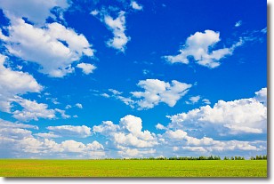
Cumulus clouds are fluffy and textured with rounded tops, and
may have flat bottoms. The border of a cumulus cloud
is clearly defined, and can have the appearance of cotton or cauliflower.
Cumulus clouds form at low altitudes (rarely above 2 km) but can grow very tall,
becoming cumulus congestus and possibly the even taller cumulonimbus clouds.
When cumulus clouds become taller, they have a greater chance of producing precipitation.
Next Topic: Drizzle
Current conditions powered by WeatherAPI.com


